
Claremont
Homes from the 1920s, local shops on Claremont Avenue, and trails into Claremont Canyon
The Claremont Neighborhood
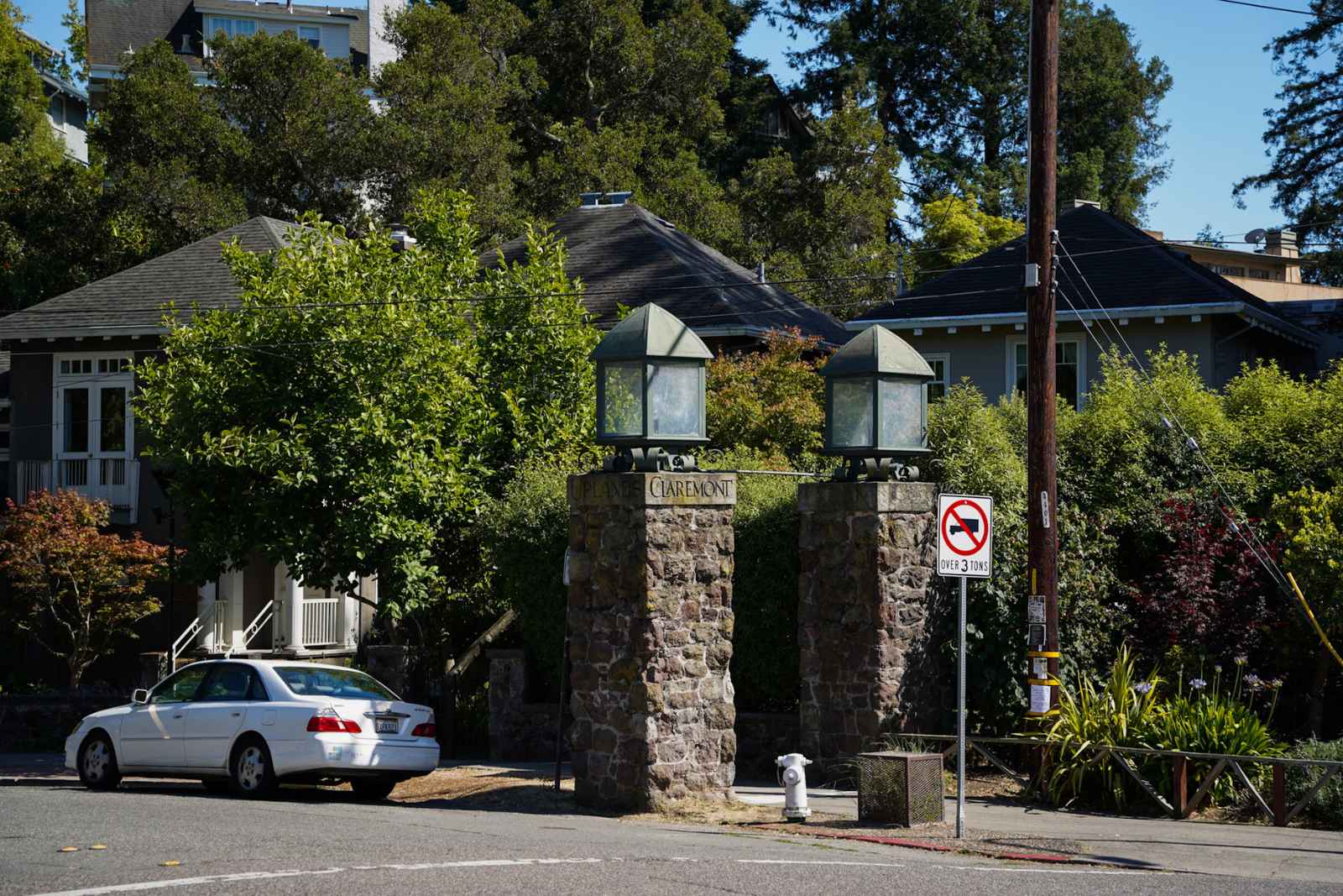
Claremont is a residential neighborhood in southeast Berkeley. It is bounded by Derby Street to the north, Claremont Avenue to the west, and The Uplands to the south. The Berkeley city limit at Grizzly Peak forms the eastern edge. These boundaries are approximate, as neighborhood boundaries in Berkeley generally are.
The neighborhood is built around the Claremont Hotel, now the Claremont Club & Spa. The white hotel opened in 1915 and sits on the line between Berkeley and Oakland. This page describes the Berkeley side of the neighborhood.
The streets around the hotel have large homes built mainly in the 1920s. East of Claremont Avenue the streets climb toward the ridge. Homes at higher elevations can have Bay views, and they also have higher fire risk and more complicated insurance. Trails into Claremont Canyon Regional Preserve start from the upper streets.
Megan’s take
“Claremont is in the southeast part of Berkeley where flat streets begin to climb toward the hills. Buyers here have access to larger lots, mature landscaping, and direct access to Claremont Canyon. Before they fall for a house, I ask them to confirm two things for the specific address: the fire hazard zone and what insurance will cost, and which city the property is in. The Claremont area runs up against the Oakland border, and the city of record changes the school assignment, the fire department, and the rules that apply to the house.”
What is daily life like in Claremont
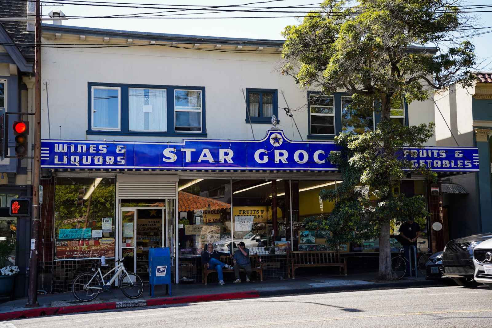
Daily life in Claremont centers on the shops along Claremont Avenue and on Domingo Avenue near Ashby Avenue.
Star Grocery, at 3068 Claremont Avenue, is the neighborhood’s anchor. Greek immigrant brothers Nick and Jim Pappas started it in 1922, delivering groceries by hand in wicker baskets before they moved to delivery trucks. The store gained its marquee with a large star during a 1949 expansion, and the Berkeley Historical Plaque Project dedicated a plaque to it in 2012. It is still a family-run business.
Two coffee options sit within a few blocks of each other. Souvenir Coffee Company, at 3084 Claremont Avenue, opened in 2017 as the company’s first cafe. It serves coffee roasted in West Berkeley and is popular with people who work on laptops. On Domingo Avenue, Peet’s Coffee at 2916 Domingo opens at 5:30 am on weekdays and 6:00 am on weekends. Fournée Bakery, at 2912 Domingo, has baked French pastries, breads, and pizza since 2013.
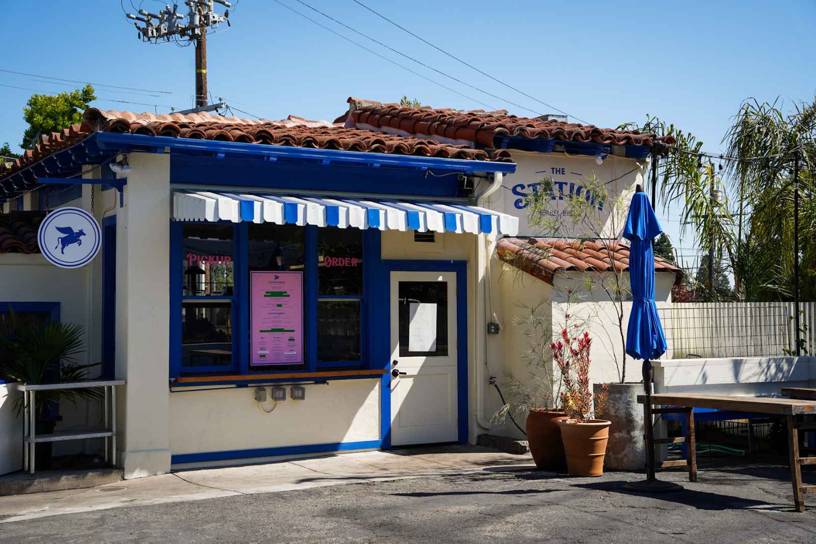
The Station Smashburgers, at 2984 Russell Street at Claremont Avenue, serves smashburgers in a former Shell gas station that opened in 1932. The pumps closed in 1969, and the building now has outdoor seating.
Afikomen Judaica, at 3042 Claremont Avenue, opened in 1991 and sells ritual items, books, jewelry, and gifts from Jewish artists, including local and Israeli designers. Nell and Rabbi Chaim have owned it since 2008, and a 2016 article in J. Weekly described it as the Bay Area’s last free-standing Judaica store.
The block also has an independent bookstore and a comics shop. Dark Carnival, at 3086 Claremont Avenue, specializes in science fiction, fantasy, and horror and has been open for more than 40 years. The Escapist Comics, its sibling store next door, sells comics.
What schools serve Claremont
Claremont addresses are in the Southeast Zone of the Berkeley Unified School District. The Southeast Zone includes Emerson, John Muir, and Malcolm X Elementary Schools. Elementary school is assigned by lottery within the zone, so living near a school does not guarantee a place there.
John Muir Elementary School, at 2955 Claremont Avenue, serves transitional kindergarten through fifth grade and is in the neighborhood. Willard Middle School is the middle school for the Southeast Zone, and was named a 2026 California Distinguished School. Longfellow Arts and Technology Middle School is available as a lottery choice. All Berkeley public school students attend Berkeley High School.
Verify the assignment for any specific address with BUSD before buying.
Parks and outdoor life in Claremont

Claremont Canyon Regional Preserve is a 205-acre East Bay Regional Park District preserve directly above the neighborhood. It opened in 1978 and has hiking and fire road access from the neighborhood streets. Trails connect the preserve to Tilden Regional Park to the north. The canyon has been the subject of a long debate over removing non-native eucalyptus trees, which burn easily, and legal challenges have delayed action several times.
Willard Park, next to Willard Middle School on Derby Street, has playing fields, tennis courts, and a pool at the adjacent recreation center.
Getting around from Claremont
The closest BART station is Rockridge. Ashby Avenue connects Highways 13 and 24 with Interstate 80. AC Transit Line 27 runs along Ashby Avenue and ends at the Emeryville Amtrak station, with a connection to Ashby BART. Walk Score rates the Claremont/Elmwood area 72.
Claremont neighborhood map

Thinking about Claremont?
I’ve represented buyers and sellers throughout this neighborhood for years. If you’d like a candid conversation about what’s available and what to expect, I’m always glad to talk.
Frequently asked questions about Claremont
Claremont Resources
Claremont resources
Links open in a new window. If you find a broken link, let us know.